


Brief report from the front, June 3, 2025
Expanding the flanks of "driven wedges" destroys the monolith of the Ukrainian Armed Forces' defense. Report by Marat Khairullin with illustrations by Mikhail Popov.

Sumy "Buffer" Zone
From the Russian Ministry of Defense report: Units of the "North" Group have liberated the settlement of Andreevka in the Sumy region through decisive operations.
Andreevka is a small village (approximately 80 residents, marked with a Russian flag).
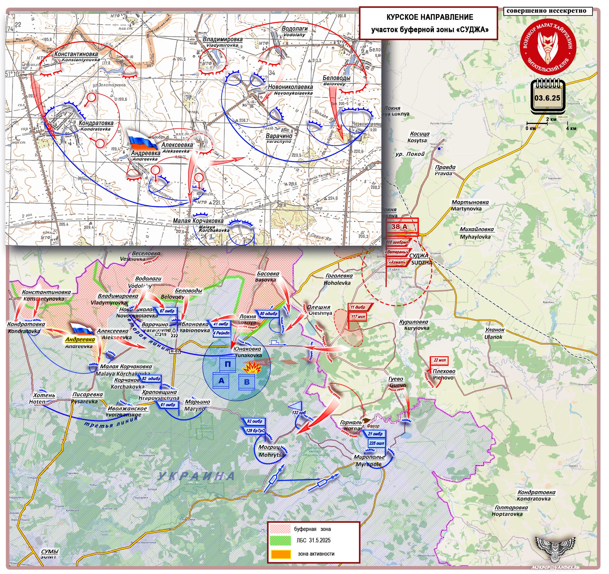
After the liberation of the settlement of Alekseevka (June 1), it became clear that our command would expand the wedge on the right flank (toward the village of Kondratovka) and move into the rear of the Armed Forces of Ukraine's defensive positions in the Nikolaevka-Yablonovka area.
As of June 3, west of Andreevka, Russian forward units have advanced to the outskirts of Kondratovka, while to the south, in the direction of Alekseevka-Malaya Korchakovka, they have reached the commanding height of 221.5. We are observing a flank expansion of the wedge driven in on June 1 and a deep envelopment of the AFU’s defensive area in Nikolaevka-Varachino-Yablonovka, which is now cut off from its flanks and has only one remaining supply route: Maryino-Yablonovka.
The key feature of our positions along the Kondratovka-Andreevka-Alekseevka-Belovody line is that we now control three watersheds in the area, providing a tactical advantage over the AFU’s positions:
- The villages of Kondratovka and Andreevka are situated on the slopes of the watershed between the Sinyak River (western slope) and its tributary stream, which transitions into the Korchakovsky Yar ravine (eastern slope).
- The Andreevka-Alekseevka line lies on the watershed between the Korchakovsky Yar ravine and the Blakhovets River.
- The Alekseevka-Belovody line is positioned on the watershed between the Blakhovets and Snagost rivers.
The AFU’s defensive area in Nikolaevka is doomed. Along with it, Yunakovka will also fall.
The Russian Armed Forces have begun the final dismantling of the AFU’s first (conditional) defensive line in this sector of the buffer zone.
Pokrovsk to Chasov Yar
Amid ongoing activity on the Pokrovsk sector of the Donetsk front, the situation near Chasov Yar appears stagnant. However, as of today, Russian forces control nearly the entire city. A methodical clearing of the outskirts and adjacent territories is underway.
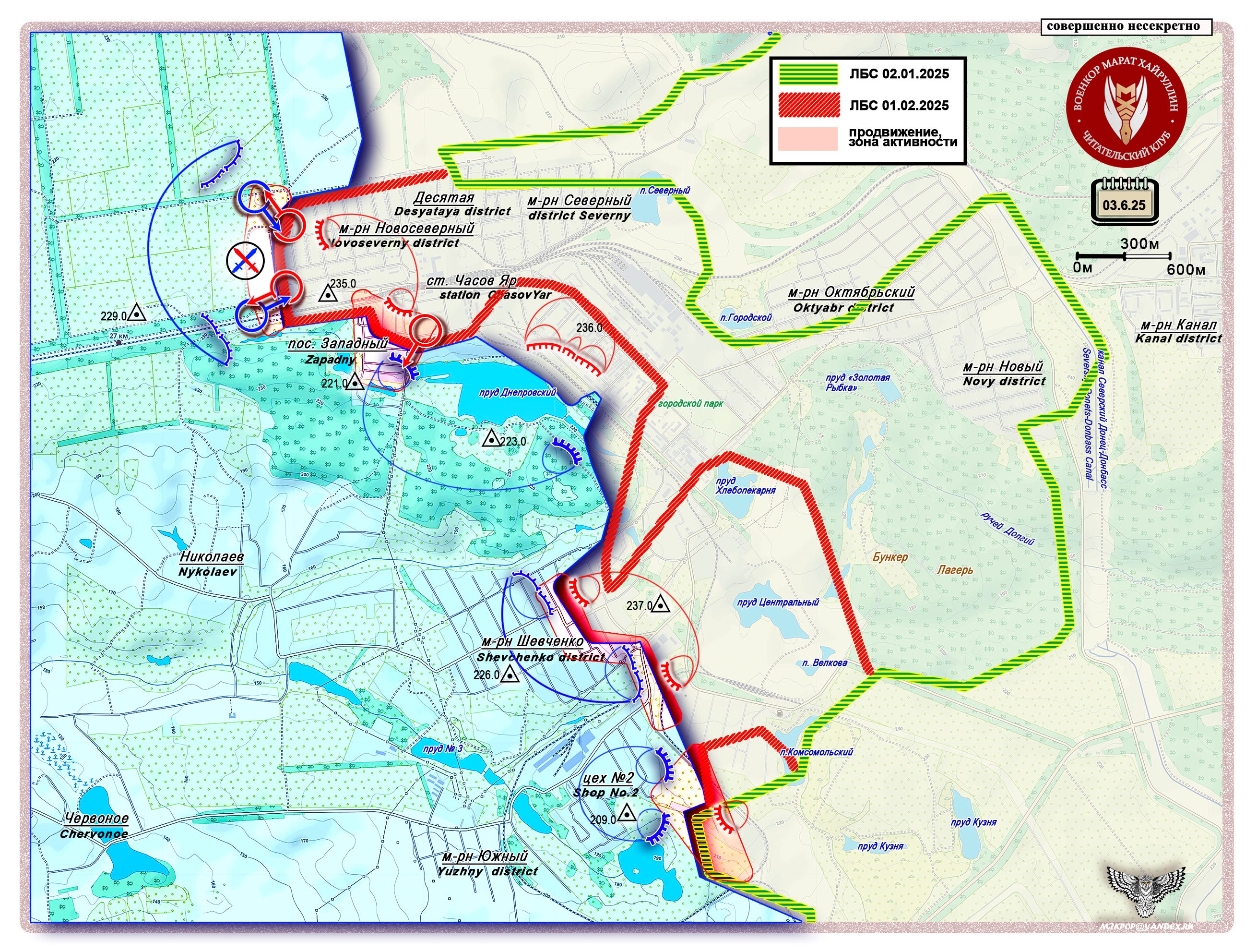
The city is situated on elevated terrain, where urban structures themselves serve as ready-made defensive fortifications hindering advancement. Additionally, the surrounding area features extremely challenging terrain—quarries, mines, ravines, and a network of ponds—all utilized in the engineering of defensive structures and obstacles.
Russian units control the commanding heights around the entire perimeter of the city. Enemy positions are lower, which is an advantageous. In our assessment, the current lull in this sector will persist until objectives are achieved by neighboring forces to the south. Once the command’s goals are met on the adjacent Dzerzhinsk (Toretsk) sector and the right flank of the Pokrovsk sector—and once a sufficiently deep envelopment line around Konstantinovka is established and reinforced—coordinated operations will begin in the Chasov Yar area.
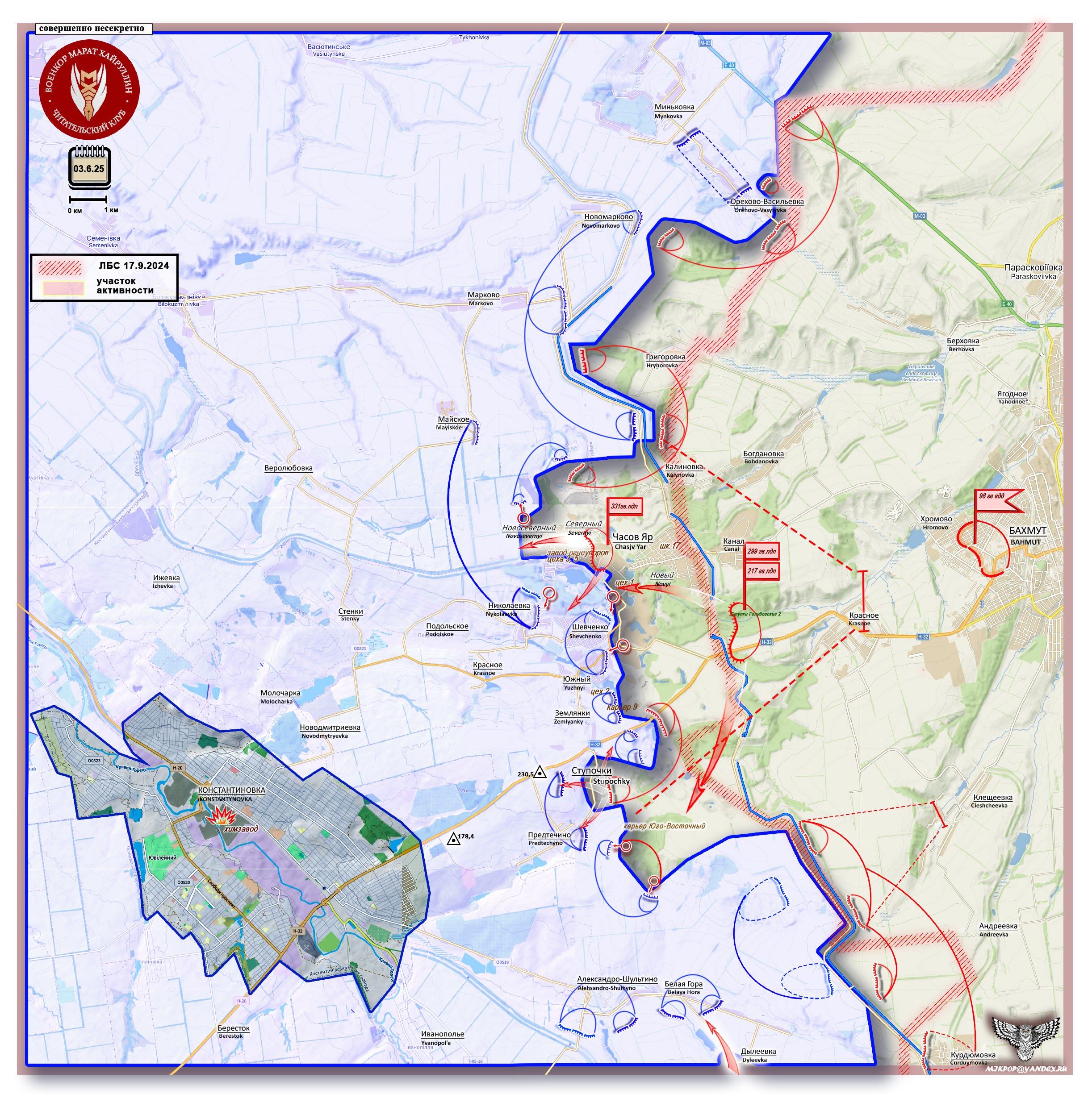
For now, the primary task in this sector is to expand control zones, develop strongpoints, supply first and second echelons with material resources, and pin down significant enemy forces. In other words—preparing a foothold to push off from when the "время Ч" ("Ch-hour" a military for the decisive moment) comes.
The Chasov Yar area, in the current operational context, serves to support the main active zones: the Toretsk sector and the right flank of the Pokrovsk sector.
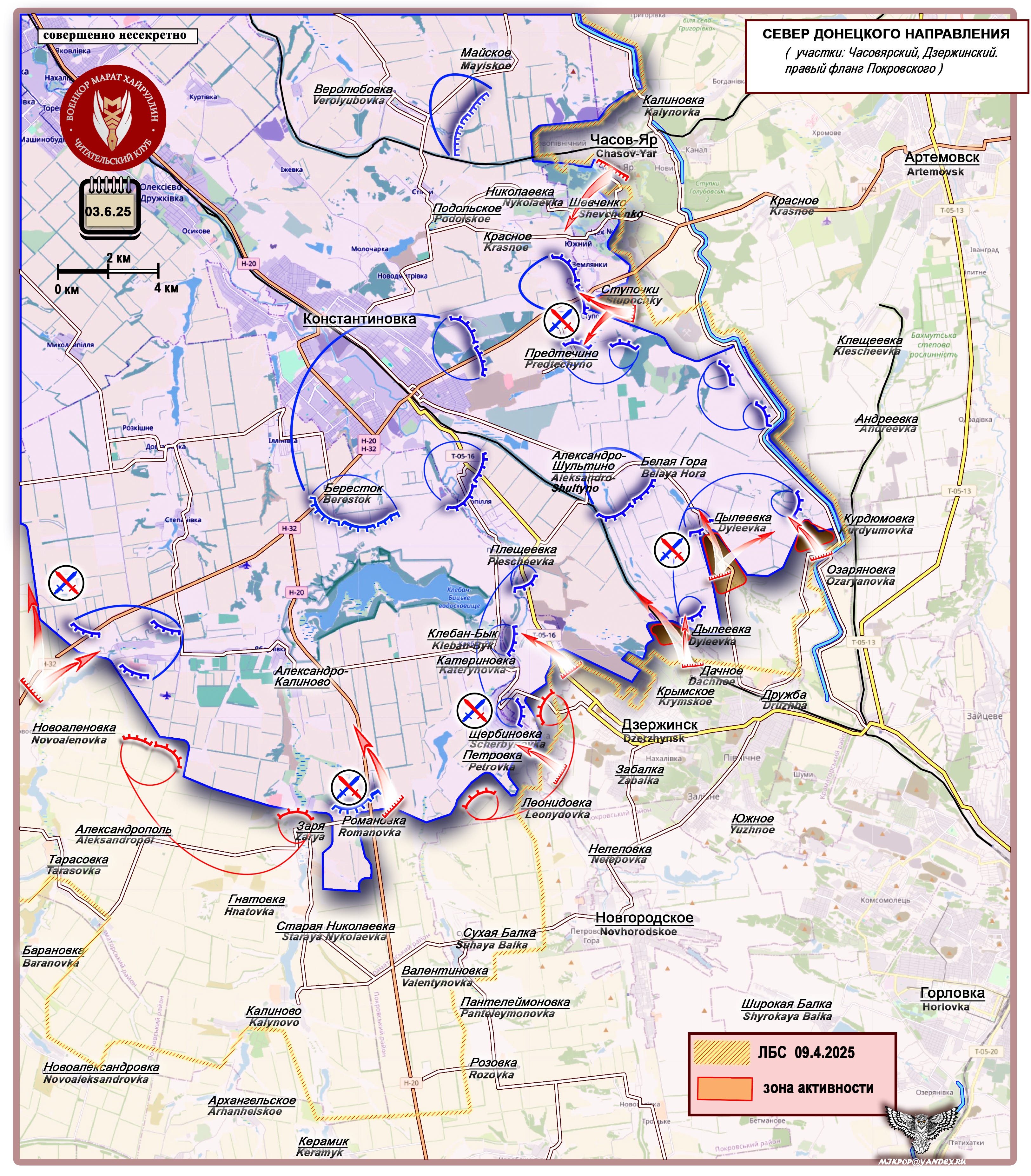
Over the past week, reports have indicated advances by Russian forces:
- In the Chasov Yar sector: the village of Stupochki.
- In the Toretsk sector: the settlements of Ozaryanovka, Dyleevka village, Dyleevka station, and Dachnoe.
- In the Pokrovsk sector: From Novaya Poltavka toward Popov Yar and Rusin Yar and from Novoolenovka (Novoalenovka on the map) to Yablunovka (the name wouldn't quite fit, but it's just northeast of “Novoalenovka” on the map).
A process of "drilling boreholes" is underway across this entire stretch of the Donetsk front. These "boreholes" are then "filled with explosives" (second-echelon forces are introduced), followed by "detonation" (flank expansion). The result is that the monolith of the AFU's defense collapses.
Thank you!
Cool stuff!!! Thanks Marat and Mikhail!!