


Brief Frontline Report – July 15th, 2025
Report by Marat Khairullin and Mikhail Popov.
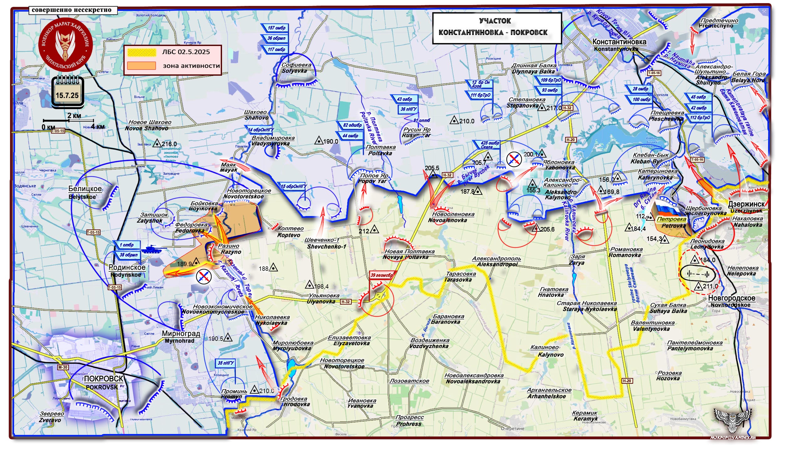
Konstantinovka-Toretsk Direction
The Russian Ministry of Defense reports: "The Russian Defense Minister Andrei Belousov congratulated the command and personnel of the 1465th Motorized Rifle Regiment on the liberation of the settlement of Petrovka (Novospasskoye) in the Donetsk People's Republic."
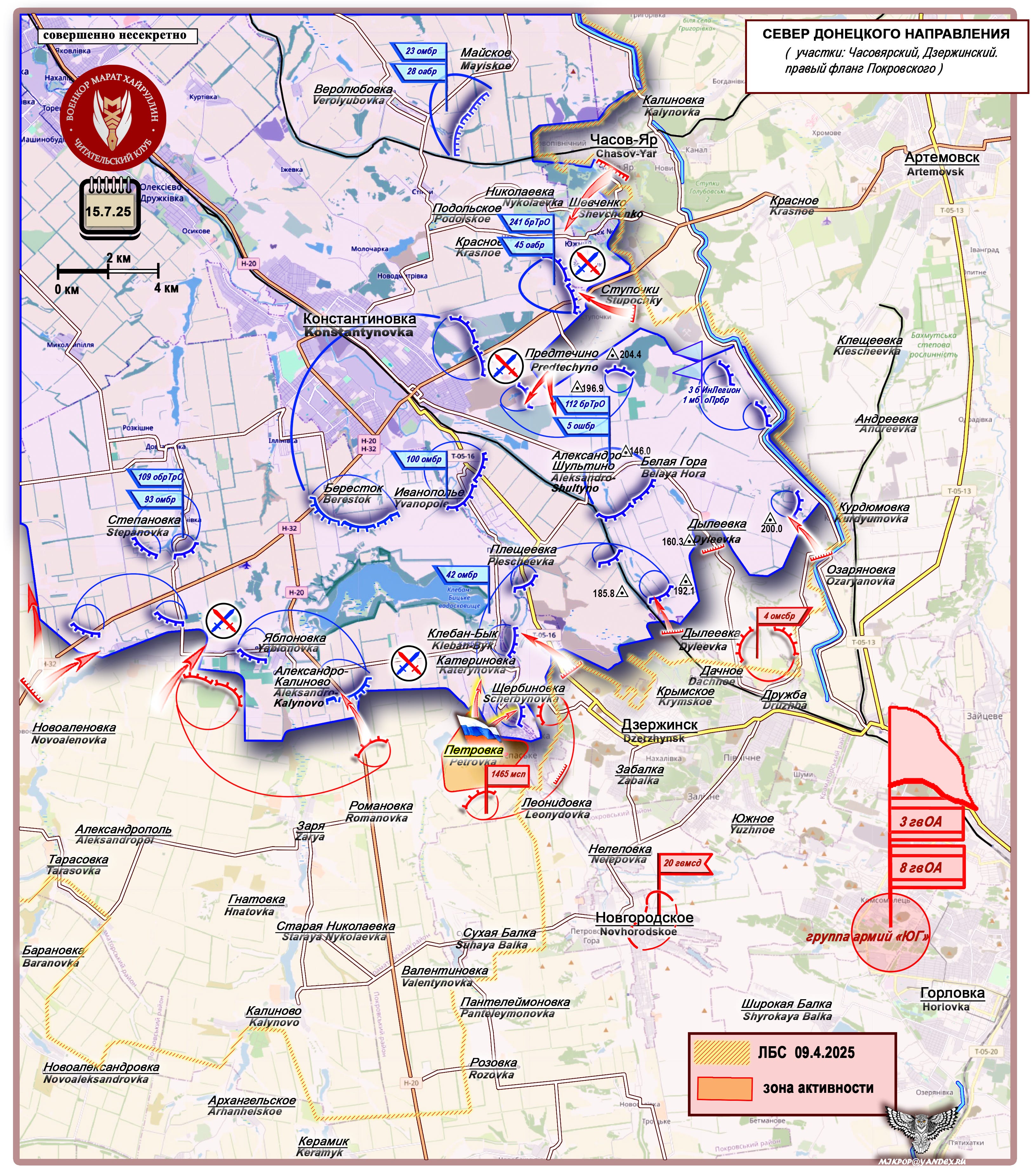
The village of Petrovka (approximately 1,000 residents) is located on the left bank of the Krivoy Torets River and is part of an agglomeration of settlements stretching continuously from north to south, starting from the city of Konstantinovka: Ivanopolye – Pleshcheevka – Kleban Byk – Katerinovka – Shcherbinovka (on the east bank) – Petrovka – Leonidovka – Nelepovka – Novgorodskoe (Ukrainian: New York, Novhorodskoe on the map).
For nearly a year, Russian forces have been gradually advancing from south to north, liberating settlements in this agglomeration—an area heavily fortified by the Armed Forces of Ukraine for many years with strongholds, weaponry, and logistical infrastructure. The terrain is complex and rugged, crisscrossed by rivers, tributaries, watersheds, ravines, and extended gullies. At the center of the southern front lies the Kleban Byk Reservoir, which serves as a key defensive anchor for several AFU positions.
The advance through such challenging terrain was achieved by securing and expanding flanks, launching multi-directional strikes, and coordinating efforts across all branches of the armed forces.
The liberation of Petrovka effectively seals the fate of Shcherbinovka. Simultaneously, continuous pressure is being applied to the left flank of the AFU’s Kleban Byk defensive hub—targeting the settlements of Yablonovka and Aleksandro-Kalinovo. There is also a high likelihood of activity on the right flank (Dyleevka – Belaya Gora – Aleksandro-Shultino), which would force the AFU to withdraw its forces toward the Berestok-Ivanopolye area, ultimately collapsing the Kleban Byk defensive node—a critical anchor for enemy defenses near Dzerzhynsk (Toretsk).
South Donetsk Direction
The Russian Ministry of Defense reports: "Servicemen of the 37th Motorized Rifle Brigade (part of the "East" Group) broke through enemy defenses on the western bank of the Mokrye Yaly River and liberated the village of Voskresenka in the Donetsk People's Republic."
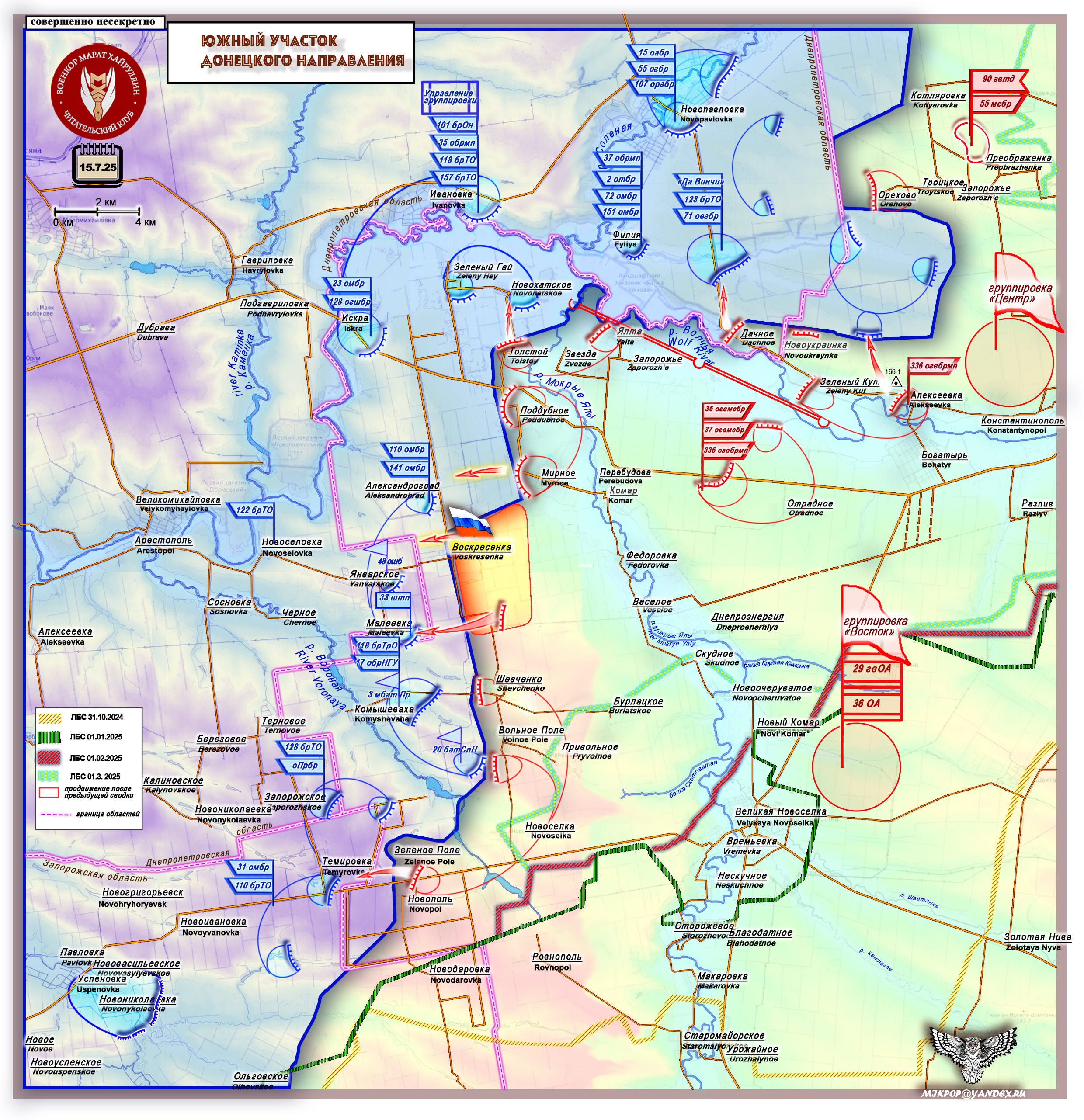
Without losing momentum, the "East" units—advancing practically on the heels of the retreating enemy—are pushing forward across a 4-kilometer-wide front toward the Russian state border. The liberated village of Voskresenka (around 500 residents) is the last settlement before the border with Dnepropetrovsk Oblast in this area.
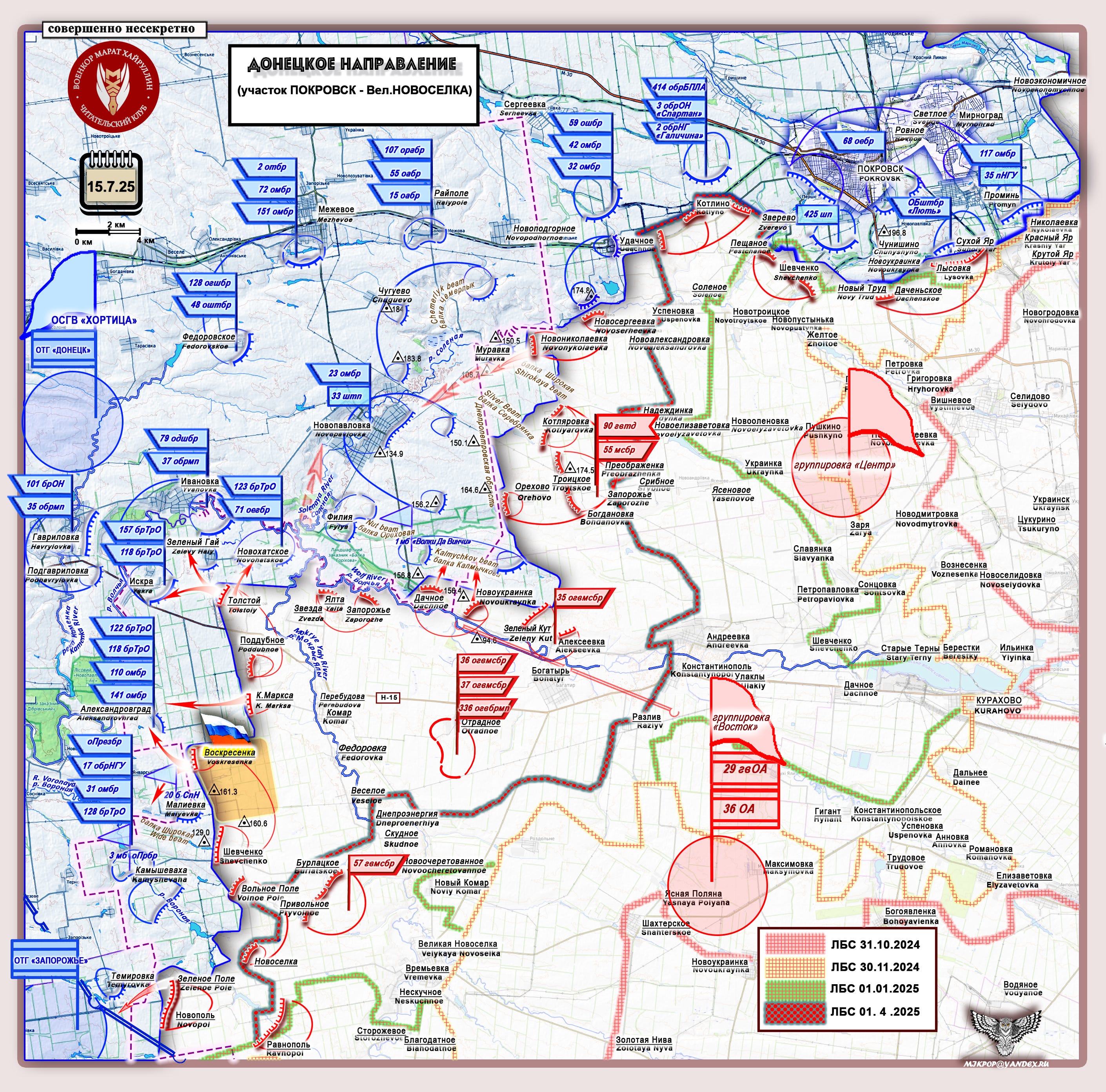
To the north, pressure is mounting on the Zeleny Gai and Novokhatskoye defense areas. Once these are neutralized, the Tolstoy-K. Marksa frontline sector will advance even further toward the border. Subsequently, the previously quiet Shevchenko-Kamyshevakha axis is expected to "come back to life."
Translation Note: When Russian is written by hand, the "г" (when typed) looks like a backward "S," and the "и" looks like our "u." Also, the typed Russian "т" looks like a western "m" when it is written by hand. Lastly, the "д" turns into something that looks like a "d." Hopefully, this helps if some of the symbols seem unfamiliar to you!
If you're paying attention to the Russian on the maps, Mikhail uses both Russian print and Russian script.
Best analysis out there fully capturing the ambience of the battleground.
God Bless the Russia Troops and Command.
I hope the Russians can finally finish this operation as early as possible. Great reporting Marat as always.